Labatie-d'Andaure
| Labatie-d'Andaure | |
|---|---|
|
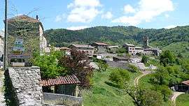
A general view of Labatie-d'Andaure | |
 Labatie-d'Andaure | |
|
Location within Auvergne-Rhône-Alpes region  Labatie-d'Andaure | |
| Coordinates: 45°01′33″N 4°29′37″E / 45.0258°N 4.4936°ECoordinates: 45°01′33″N 4°29′37″E / 45.0258°N 4.4936°E | |
| Country | France |
| Region | Auvergne-Rhône-Alpes |
| Department | Ardèche |
| Arrondissement | Tournon-sur-Rhône |
| Canton | Saint-Agrève |
| Intercommunality | Haut-Vivarais |
| Government | |
| • Mayor (2008–2014) | Christian Marliac |
| Area1 | 9.93 km2 (3.83 sq mi) |
| Population (2008)2 | 197 |
| • Density | 20/km2 (51/sq mi) |
| Time zone | CET (UTC+1) |
| • Summer (DST) | CEST (UTC+2) |
| INSEE/Postal code | 07114 / 07570 |
| Elevation |
473–1,003 m (1,552–3,291 ft) (avg. 528 m or 1,732 ft) |
|
1 French Land Register data, which excludes lakes, ponds, glaciers > 1 km² (0.386 sq mi or 247 acres) and river estuaries. 2 Population without double counting: residents of multiple communes (e.g., students and military personnel) only counted once. | |
Labatie-d'Andaure is a commune in the Ardèche department in southern France.
Population
| Historical population | ||
|---|---|---|
| Year | Pop. | ±% |
| 1962 | 348 | — |
| 1968 | 382 | +9.8% |
| 1975 | 307 | −19.6% |
| 1982 | 256 | −16.6% |
| 1990 | 203 | −20.7% |
| 1999 | 204 | +0.5% |
| 2008 | 197 | −3.4% |
See also
References
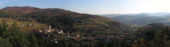
Panorama of the commune
| Wikimedia Commons has media related to Labatie-d'Andaure. |
This article is issued from Wikipedia - version of the 10/28/2016. The text is available under the Creative Commons Attribution/Share Alike but additional terms may apply for the media files.